Software
God's Eye View: the open map that gathers signals from the planet in real time
Bilawal Sidhu's viral tool places flights, ships, satellites, earthquakes, fires, and public cameras over a 3D globe. Understand what is really live, what data is simulated, and why open source doesn't mean surveillance without limits.
By Ederson Andrade · August 29, 2026 · 9 min read
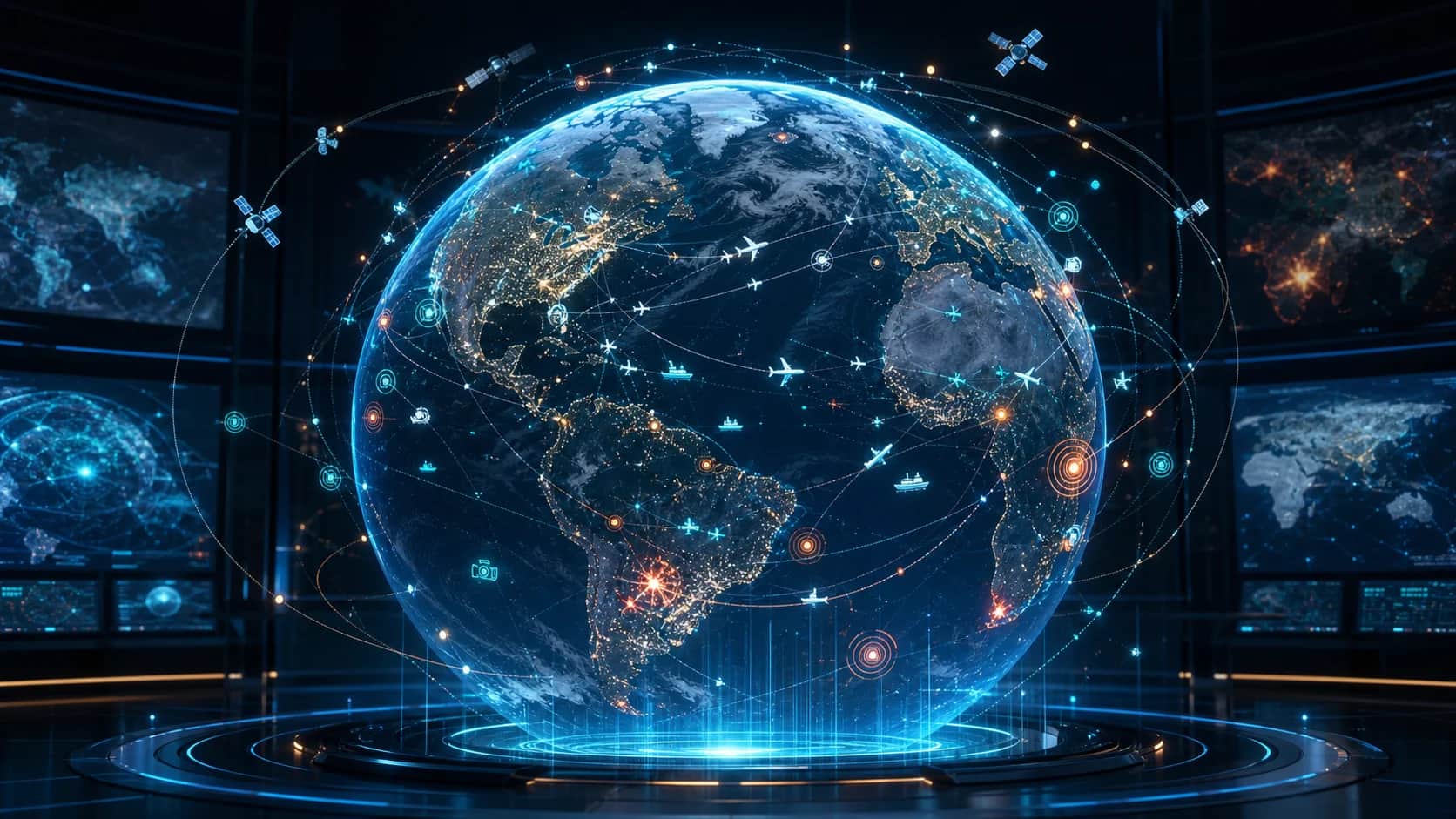
A terrestrial globe in three dimensions occupies the screen. Airplanes cross continents, ships advance across oceans, satellites travel through their orbits, and alerts appear about earthquakes, fires, and other activities. At first glance, the God's Eye View It looks like the dashboard of an intelligence agency. The difference is that the signals gathered there are public and the code can be examined by anyone.
The project of Bilawal Sidhu It gained attention on social media by showing how much it is possible to observe when data spread across dozens of services is organized on the same map. In August 2026, the tool was no longer just a series of demonstrations and was open sourced on GitHub.
The result is visually striking, but it needs to be understood without exaggeration. God's Eye View doesn't access secret satellites, doesn't see anywhere live, and doesn't turn an ordinary person into an espionage agent. It's an experimental space intelligence platform that combines 3D maps, open sources, reconstructions, and a command-room-inspired interface.
From WorldView to God's Eye View
Before receiving its current name, the project was presented as WorldView. Sidhu published videos in which he gathered geospatial data to observe air traffic, vessels, satellites, interference in positioning systems and high-profile events.
The demonstrations drew attention because they replaced the common experience of open-source intelligence, often divided between maps, spreadsheets and various browser tabs, with a single view of the planet. According to the official repository, the series has surpassed five million views on YouTube and has accumulated tens of millions of views on other networks.
On June 22, 2026, a provisional repository was created on GitHub. At the end of July, the public release was scheduled for August 18. From that date on, developers had access to the project's base, documentation, data sources, and contribution rules.
Interest was fast. On August 26, just over a week after opening, the repository already registered more than five thousand stars and about 1.3 thousand forks on GitHub. These numbers change continuously, but they help show the size of the curiosity around the tool.
What's on the map
God's Eye View arranges different layers on a photorealistic globe. Among the features described in the documentation are:
- civil and military flights based on public transponder signals;
- ships identified by AIS transmissions;
- satellites calculated from public orbital elements;
- earthquakes published by the United States Geological Survey;
- fire outbreaks obtained by NASA's FIRMS system;
- cameras installed in places disclosed by authorities and public services;
- traffic, infrastructure, dams and submarine cables;
- space missions and reconstructions of recent launches;
- radio stations associated with places on the map.
It is possible to select an object, follow its trajectory and zoom in on the camera. On certain flights, the interface offers a cockpit view that follows the terrain. Visual modes mimic night vision, thermal imaging, old monitors and other sensors, although these filters are graphic effects and not measurements produced by real equipment at that point.
The map can also receive annotations, routes, and measurements. An optional voice function allows you to ask the system to find a place, activate layers, or answer questions about what's on the screen. This part uses an artificial intelligence API and relies on a key configured by the user himself.
For those who follow the evolution of spatial computing, the proposal talks to devices that try to bring digital information to the field of vision. TecEdi explained this change when analyzing the XREAL Aura glasses and Android XR. In God's Eye View, however, the experience remains focused on the browser and a 3D globe.
Where the data comes from
The appearance of a secret dashboard hides an architecture made up mostly of well-known services. The project cites OpenSky Network and adsb.lol for aviation, AISStream for vessels, CelesTrak for orbits, USGS for earthquakes, OpenStreetMap for geographic information, and Open-Meteo for weather conditions.
Other layers require registration or their own key. The photorealistic map uses the Google Maps platform, while fire data can use NASA FIRMS and live traffic can depend on TomTom. Voice recognition and AI-generated summaries are optional and use an API with per-use charging.
This explains why the tool is not simply a file that shows everything for free. The code is open, but many sources remain subject to the rules, limits, and prices of their suppliers. Some work without registration; others offer free quotas; and certain features can incur costs as they use them.
Not everything is really live
One of the most important decisions of the project is in the way it identifies the quality of the information. The documentation differentiates between live, delayed, partial, unavailable, estimated, and simulated states.
Flights, for example, are shown with a collection interval so that the animation can be smoothed out. The position of a satellite is calculated from recent orbital elements, not received as a video transmission. A public camera may have a known position, but its field of view can still be estimated until it undergoes calibration.
Self-keyless transit uses a simulation identified as such. Reproductions of space launches receive the estimated reconstruction mark. On the high seas, vessel coverage may decrease because terrestrial AIS signals do not reach the entire ocean.
These differences matter. Putting multiple pieces of information on the same map can create a false sense of accuracy. A compelling interface doesn't eliminate delays, areas without coverage, misidentification, or limitations of the original source.
The project itself warns that the data may be incomplete, delayed, modeled, or incorrect. The tool should not be used for air or sea navigation, emergency response, medical decisions, security operations, or any situation where an error could put people at risk.
The map is not designed to track people
The name "Eye of God" may suggest total surveillance, but those responsible have established an explicit border. The platform works with events, vehicles, satellites, infrastructure, cities, fires and other space elements. It does not accept name search, facial recognition or individual tracking features.
This rule does not resolve all ethical discussions. Public data can take on another meaning when it is gathered, filtered, and presented in a very accessible interface. An isolated camera, an airplane route, and the position of an installation may seem banal separately, but the combination creates a broader view.
Therefore, open-source code is relevant in two ways. It allows developers to learn and contribute, but it also makes system choices available for auditing. Still, open source does not mean the absence of responsibility. Anyone who installs, modifies, or publishes a copy must respect laws, licenses, and limits of each source.
Open source doesn't mean all data is free
The God's Eye View code has been published under an MIT license, which allows use, modification, and distribution. This permission does not automatically extend to maps, images, models, and databases used by the application.
The documentation maintains a specific list of sources and attributions. Data derived from OpenStreetMap follows the ODbL license. The TeleGeography submarine cable set included in the repository is intended for non-commercial use and must be removed or licensed separately in a commercial deployment. Headlines provided by Google News also have their own conditions for personal and non-commercial use.
This distinction is a useful lesson for any project that combines third-party content: a permissive license to the program does not grant rights to everything that appears within it.
Installing requires attention to costs and safety
The current version asks for Node.js 24.14 or 26 and a key from the Google Maps platform to offer the photorealistic globe. The documentation states that several layers can work without registration, but the full experience depends on optional keys and services with different limits.
By default, the development server accepts connections only from the machine itself. This is important because some keys are on the server and are used by intermediate routes. By releasing the application to a local network or to the internet, anyone with access can consume these routes and generate usage in the configured accounts.
Google Maps and Cesium keys are deliberate exceptions because they need to reach the browser. The project directs restricting them by domain and by API. Other credentials, such as those used for voice, boats, and OpenSky authentication, remain on the server.
It is also necessary to keep track of dependencies. An open application can fix problems quickly, but it remains subject to the common risks of the package chain. This care has gained even more importance after campaigns like the one he spread More than a thousand malicious NPM packets.
The security document describes the tool as an on-premises client focused on exploration, demonstrations, and learning, not as a production-ready, hardened service. Publishing an instance without reviewing limits, keys, licenses, and network access can lead to unnecessary costs or exposure.
Why the project drew so much attention
Much of the impact comes from the presentation. Plane, earthquake, and satellite tracking services have been around for years. God's Eye View didn't invent these sources, but it turns them into a coherent visual experience, with a cinematic camera, 3D objects, filters, and voice commands.
This reduces the distance between a database and the perception of what is happening. Instead of reading coordinates or switching between pages, the user observes spatial relationships in the same environment. The feeling of controlling a spy satellite is, in practice, the result of design, computer graphics and integration of public APIs.
The video below was published by Bilawal Sidhu to introduce the opening of the project and demonstrate the experience.
An open laboratory, not a perfect vision of the planet
God's Eye View shows how open-source intelligence can become more visual and accessible. It also reveals a growing challenge: the more convincing the interface, the more important it becomes to explain the origin, delay, and reliability of each element.
Today, the project should be seen as a base for experimentation. It allows you to study 3D maps, data visualization, spatial intelligence, public APIs, and voice interaction. It does not replace professional systems, does not offer full coverage, and does not turn estimates into facts.
Its greatest merit is perhaps to make visible something that is normally scattered: the planet already produces an enormous amount of public signals. The "Eye of God" does not see everything. It just puts many of these signals in the same place and shows how much we can learn, and also how much we can misinterpret, when we look at them together.